Hurricanes are the most destructive force on Earth. Our science team has been developing tools to better understand these storms which will help forecasters predict the strength and storm path more accurately.
NASA’s Tropical Cyclone Experiment was performed by the Tropical Weather Analytics, Inc. science team in support of the CyMISS (Tropical Cyclone intensity Measurements from the ISS) project funded by CASIS (Center for the Advancement of Science in Space) which manages the ISS US National Laboratory for NASA.
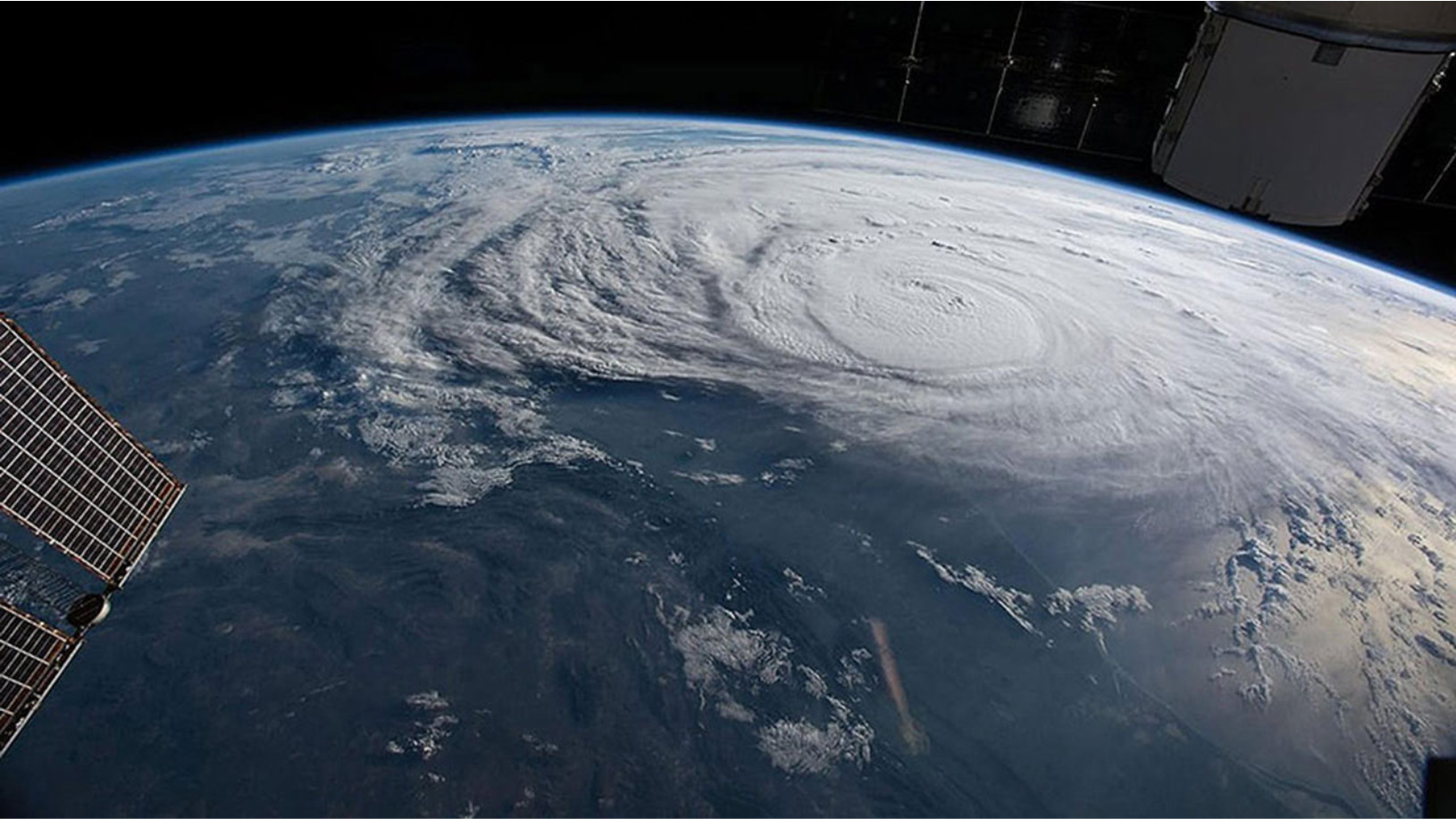
In order to accomplish this, the astronauts aboard the ISS had to receive detailed instructions on how to set the camera and take pictures of tropical cyclones (TC). NASA together with our team wrote two protocols (one for daylight and one for night observation) which instructed the astronauts specifically how to program the camera for image acquisition. The inputs lacking were the specification of date and time and which cupola window to use.
This involved writing a program which was to track two moving objects (ISS and TC) and compute their times of intersection. This program also required the incorporation of solar and lunar ephemerides. ISS track was obtained by the use of two line NORAD satellite elements and TC track was obtained from NOAA hurricane movement estimates. The program also computed look angles and solar/lunar glare which was needed to avoid glint problems. Also, lunar angles were critical in the determination of the intensity of illumination during night observations. All calculated intersections were analyzed to determine the one which best suited our purpose to obtain the “perfect” set of images for that TC.
That accomplished, the observation request consisting of date/time, cupola window number and look angles as well as ISS and TC positions, was sent to NASA in Huntsville, AL for review and preliminary evaluation. It was then forwarded to NASA in Houston, TX for final approval.
If pictures were taken, the file was downloaded and forwarded to Andrew LePage for analysis (Andrew serves as Chief Scientist of Tropical Weather Analytics, Inc.
NOTE: Night observations also revealed stars in the background and Tropical Weather Analytics, Inc. team desired to ascertain their identity and magnitude. This necessitated writing another program to calculate the Right Ascension and Declination of the background sky. This was finally solved by the use of spherical trigonometry and the location was accurate enough to identify the stars in the Star Atlas.
You can learn more about how our research has impacted hurricane forecasts and how our satellites will provide a global hurricane observation system in the link below.
Disrupting the Way We Understand the World’s Deadliest Storms
