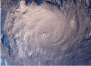
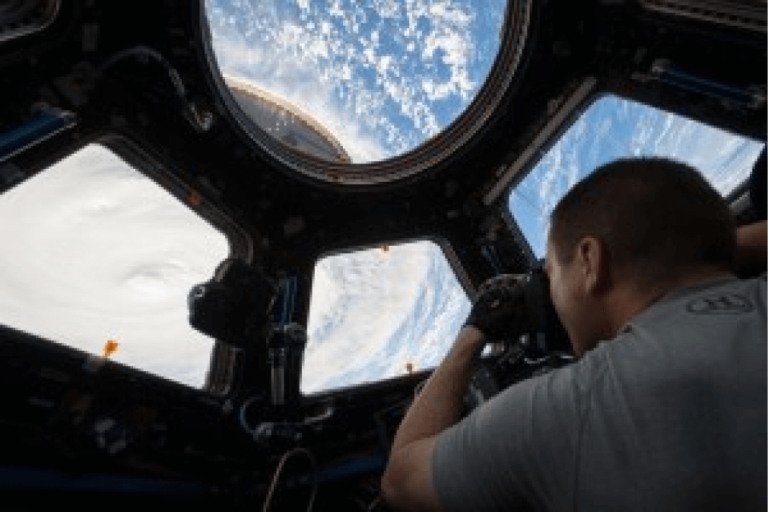
The work at Tropical Weather Analytics, Inc. to perform precision stereo observations of storms was built on years of prior studies and flight experiments. From 2014 to 2019, NASA’s Tropical Cyclone Experiment was performed by our science team in support of the CyMISS (Tropical Cyclone intensity Measurements from the ISS) project funded by CASIS (Center for the Advancement of Science in Space) which manages the ISS US National Laboratory for NASA. The goal of CyMISS was to acquire image sequences from the ISS of intense tropical cyclones (TCs), such as hurricanes and typhoons, to support the development of an improved remote sensing method to determine the strength of these destructive storms more accurately using stereoscopy in combination with a physics-based Carnot engine model.
Because of the technical limitations of such photography, even when using the specially designed photography protocol the science team developed for the ISS crew, performing meaningful, quantitative pseudo-stereo reconstructions of the storms observed was not possible using these images because of the lack of required precision pointing information. In support of the project’s science goals, these image sequences have been used successfully to meet the following, more limited objectives to prove the practicality of stereo observations of such dynamic storms:
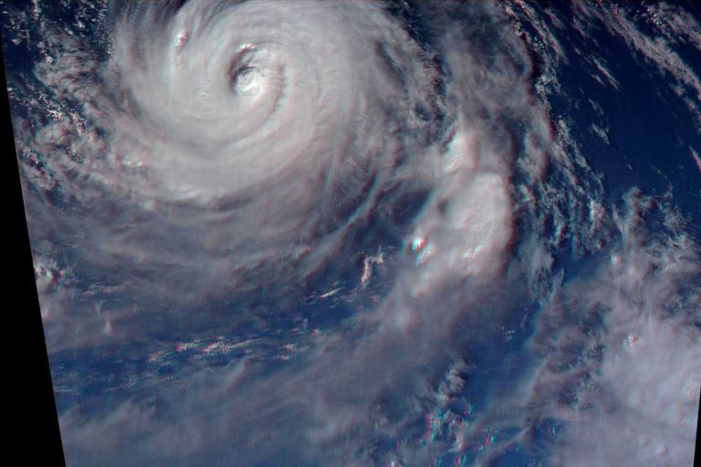
- Characterized the scene structure near the eye of a TC on spatial scales of 100 meters or better.
- Characterized the persistence of scene structure and how it evolves over the course of 100 to 200+ seconds with a temporal resolution on the order of one second.
- Provided realistic image sequences to support the development of precision stereo reconstruction software capable of absolute altitude accuracies of 100 meters.
ISS crew photography was the only practical means of providing the data we required. The resolution and imaging rate from weather satellites are too low while commercially-available satellite imagery covers too small an area at high resolution. While these ISS image sequences could not be used for precision cloud altitude measurements, they were sufficient to create visually stunning 3D images of many of the 80 TCs observed during this five-year program giving a foretaste of the power of this new tool.
For more examples of images acquired during the CyMISS program, check out the CyMISS Image Gallery.
