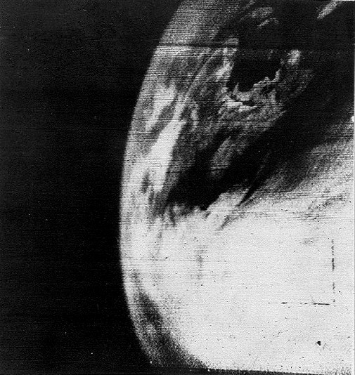
For space enthusiasts, and many of the lay public alike, there is a certain thrill in seeing a picture of home taken from space. For native New Englanders like myself, the first image of home taken from space came from NASA’s TIROS 1 weather satellite moments after it was inserted into orbit on April 1, 1960. (see “The First Weather Satellite”). Crude by today’s standards, this television image provided meteorologists with their first glimpse of weather patterns from orbit and was the beginning of nearly continuous monitoring of weather from space which continues to this day after over six decades.
As imaging technology improved over the following years, the quality of the pictures of New England and elsewhere around the globe also improved. But these were just two-dimensional (2D) views which give no ready sense of the relative altitudes of the clouds and other features in the scene. What is needed to provide a viewer with a sense of depth in a scene are a pair of images taken from two vantage points. The brain takes such stereo image pairs and creates a three-dimensional (3D) view where the relative distances of objects of the scene can be readily discerned. The first stereo images of the Boston area (where Tropical Weather Analytics, Inc. is based) were probably taken in the 1960s by the Soviet Union’s Zenit-series of reconnaissance satellites to support mapping of the area’s military, industrial, and growing high tech facilities (see “The Legacy of Vostok”). But any such imagery is still unavailable in Russian intelligence archives. The first opportunity to acquire openly available stereo imagery of Boston from orbit would have to wait for the launch of NASA’s Skylab space station in May 1973.
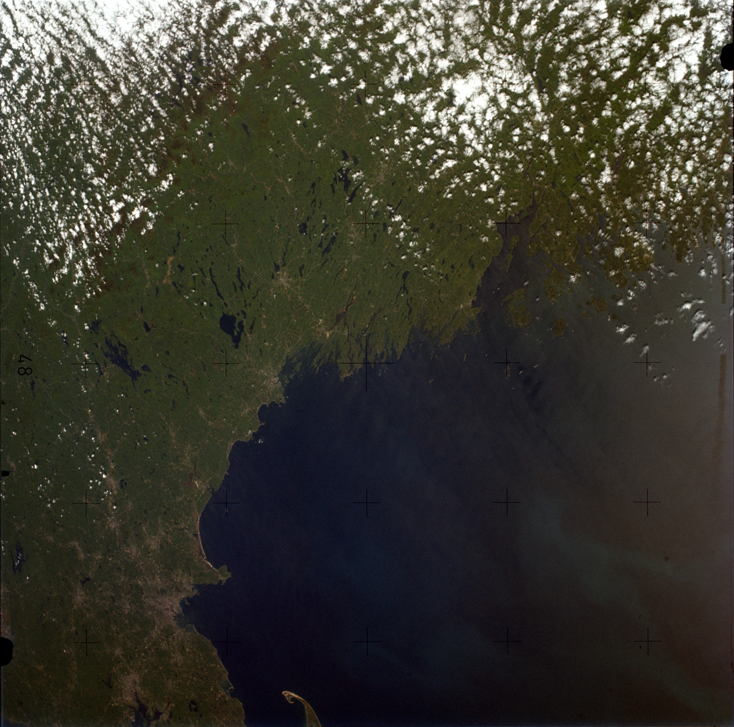
The Skylab space station was placed into an orbit with a 50° inclination which would periodically pass over all the continental US including New England – the first crewed American spacecraft to fly at such a high inclination. In addition to astronaut photography (like the image shown above), Skylab carried a suite of then-state-of-the-art remote sensing instruments including film-based cameras operating at visible and near infrared wavelengths. Among these cameras was the S190A Skylab Multispectral Experiment which included a set of six 70 mm film cameras which took overlapping swaths of color-filtered images covering visible and near infrared wavelengths. With each successive set of photographs overlapping the previous set by 50%, it is possible to create 3D images of the overlapping region with a stereo baseline of about 80 kilometers.
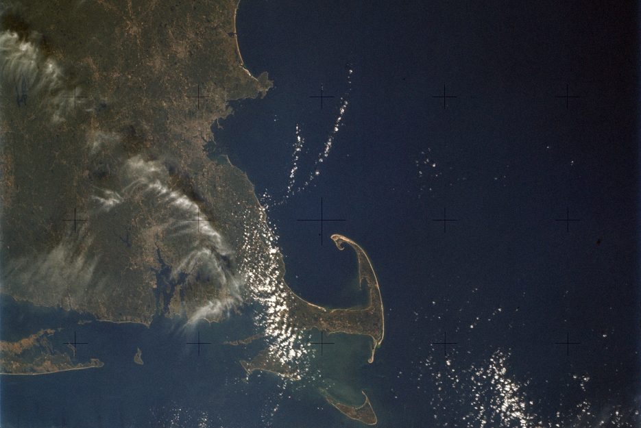
The first (and only, it would turn out) clear views of the Boston area from the S190A Skylab Multispectral Experiment were acquired at about 13:51:50 GMT (11:51:50 EDT) on September 21, 1973 during the 59-day Skylab 3 mission. Using the red-filtered photographs covering the wavelength of 600 to 700 nanometers (which provides the greatest contrast between the clouds and ground or water below), the anaglyphic 3D image (left eye red, right eye blue) shown below was created. It clearly shows the wispy cirriform clouds on the left side of the image far above the ground while the puffy cumulus clouds over the area just south of Boston are at lower altitudes. This illusion is created by parallax – the effect where the apparent position of an object appears to shift when viewed from different positions. The larger the parallax, the closer the object is to the observer (i.e. the higher the object appears above the ground, in this context)
![]()
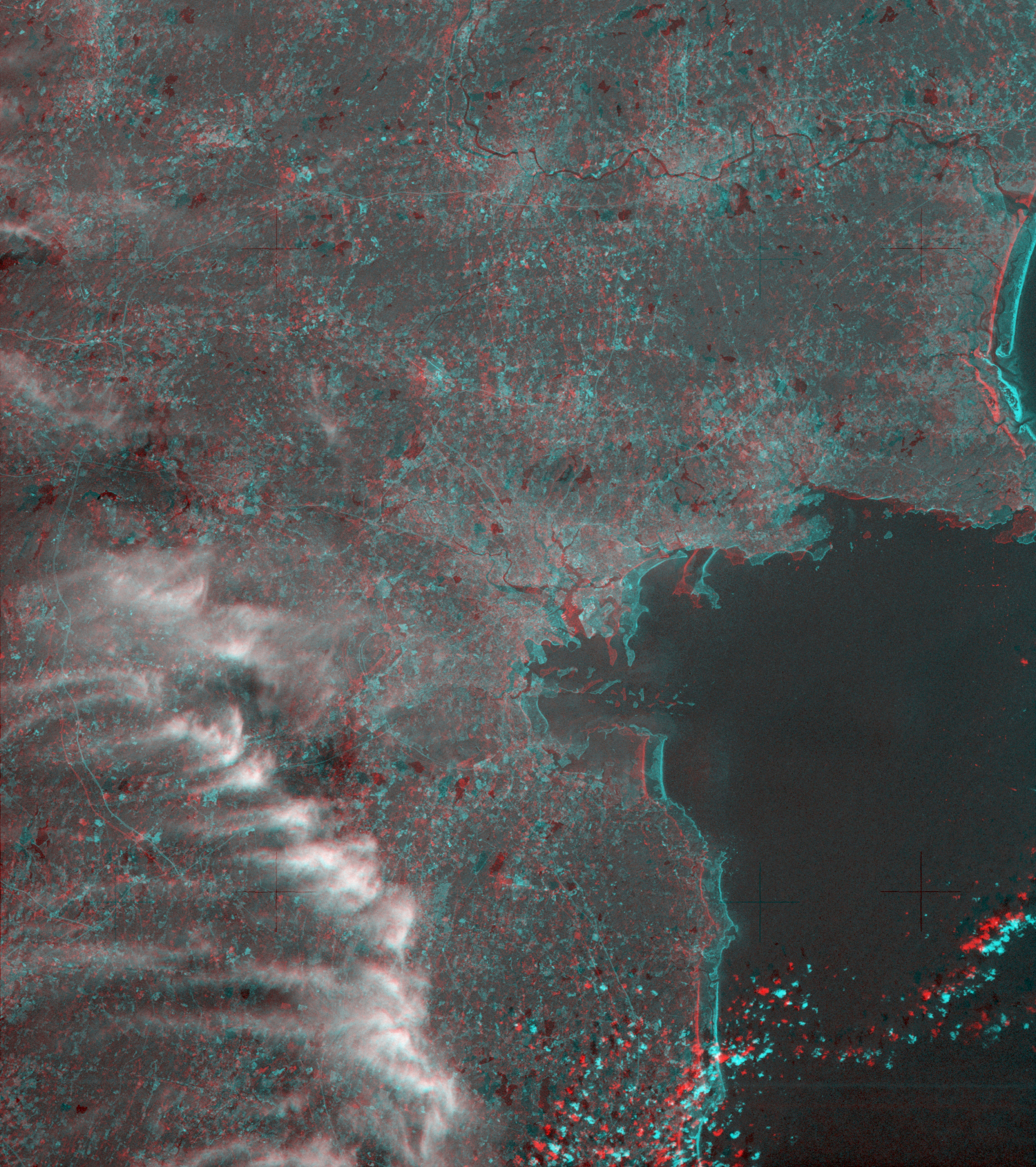
While visually pleasing, using such stereo image pairs to derive the altitude of these cloud would produce inaccurate results. These images were taken about ten seconds apart with the motion of Skylab over this time providing the stereo baseline in a technique known as pseudo-stereo. While such a technique works well for performing stereo analysis of fixed ground features for topographic mapping, the motion of the clouds during that time will affect the parallax measurements needed to measure the cloud altitudes resulting in skewed measurements.
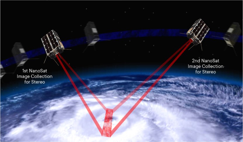
The satellites of the Orbital Weather Warning System (OWWS), like the Hurricane Hunter Satellites being developed by TWA, will operate in pairs to acquire simultaneous views of a scene from two points to provide true stereo measurements of clouds for the first time from low Earth orbit. Using sequences of such stereo image pairs, it is not only possible to accurately measure the altitudes of the cloud features visible in images like this, but also measure their motions in all three dimensions to provide wind data including unique measurements of vertical winds.
Related Reading
Drew LePage, “The Hurricane Hunter Satellites”, Drew Ex Machina, May 15, 2022 [Post]
Drew LePage, “Pictures of Home from Skylab”, Drew Ex Machina, October 24, 2019 [Post]
General References
Skylab Earth Resources Data Catalog, JSC 09060, NASA Johnson Space Center, 1974
Skylab Explores the Earth, NASA SP-380, 1977

I am not sure where you’re getting your info, but good topic. I needs to spend some time learning much more or understanding more. Thanks for magnificent info I was looking for this information for my mission.
Somebody essentially help to make significantly articles I’d state. This is the first time I frequented your web page and up to now? I surprised with the research you made to make this actual post incredible. Fantastic job!