One of the precursor projects for Tropical Weather Analytics’ Hurricane Hunter Satellites was the CyMISS (Tropical Cyclone intensity Measurements from the ISS) project which ran from 2014 to 2019. Funded by a series of grants from CASIS (Center for the Advancement of Science in Space) which manages the ISS US National Laboratory for NASA, CyMISS was performed by the science team at Visidyne (the corporate antecedent of Tropical Weather Analytics) for NASA’s Tropical Cyclone Experiment as part of NASA’s CEO (Crew Earth Observations) activities on the International Space Station. The goal of CyMISS was to acquire image sequences of intense tropical cyclones (TCs), such as hurricanes and typhoons, from the ISS using a specially designed photography protocol (see “The Cyclone Intensity Measurements from the ISS (CyMISS)”) to support the development of stereographic imaging techniques of these destructive storms. These techniques will allow the altitudes of the cloud tops near the eye of TCs to be precisely determined so that these TCs can be more accurately characterized compared to existing remote sensing methods (see “Using the Carnot Engine Model to Characterize Hurricanes from Orbit”). Because of how these stereo images are acquired, processed, and analyzed, the motion of cloud features can also be tracked to derive the winds in three dimensions including unique measurements of vertical winds – a vital input for accurately modelling the future track and intensity of TCs (see “The Impact of New Satellite Wind Measurements on Hurricane & Tropical Cyclone Forecasting”)
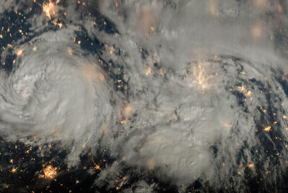
During the course of this five-year project, the CyMISS project science team (which is now the core of the TWA science team) amassed a large collection of storm images that we wish to share. During the last months of the CyMISS project, the science team was investigating a number of improvements to the observing techniques being employed. One of the investigations involved observing storms at night using moonlight as the source of illumination. One of the first storms to be photographed under moonlit conditions in support of CyMISS was on May 30, 2018 by ISS Expedition 55. During an extended nighttime imaging sequence, they observed of the remains of what once was Tropical Storm Alberto – the first named storm of the 2018 Atlantic hurricane season.
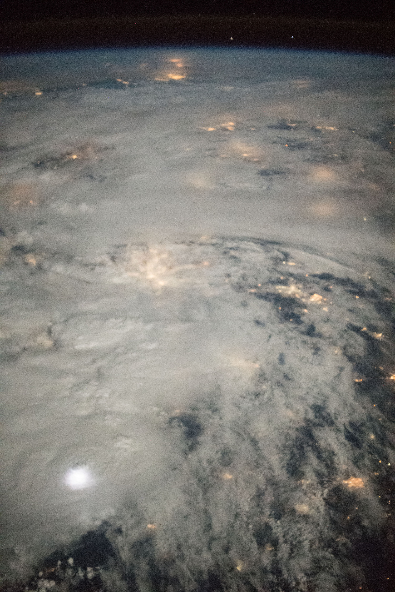
Our 3D view of the remains of Tropical Storm Alberto was created using an extended sequence of 490 images like the sample image shown above. When the eight-minute photography session started at 06:47:08 GMT (1:47:08 AM CDT) on May 30, 2018 ((see “ISS Daily Summary Report – 5/30/18”), the Moon was 15½ hours past full and it had been 1½ days since Alberto made landfall over the Florida panhandle. By this time, Alberto had been downgraded to a tropical depression with sustained winds of just 56 kph (35 mph) with rain stretching from the Gulf coast northward towards the Ohio valley. The full sequence of images from this session is shown in the video below. The actual remains of Alberto are fully visible at about the 1:00 mark.
A synoptic 2D color view created from these ISS photographs taken that evening is shown below. In order to create this mosaic, the individual photographs from the original image sequence were remapped to approximate an overhead view before the frames were stitched together into a synoptic view covering an area of approximately 4,000 by 1,200 kilometers stretching from the American Great Plains on the left to the island of Hispaniola on the right. A high-resolution version of this 2D mosaic with an image scale of ~1.6 kilometers/pixel can be viewed by clicking on the image below.
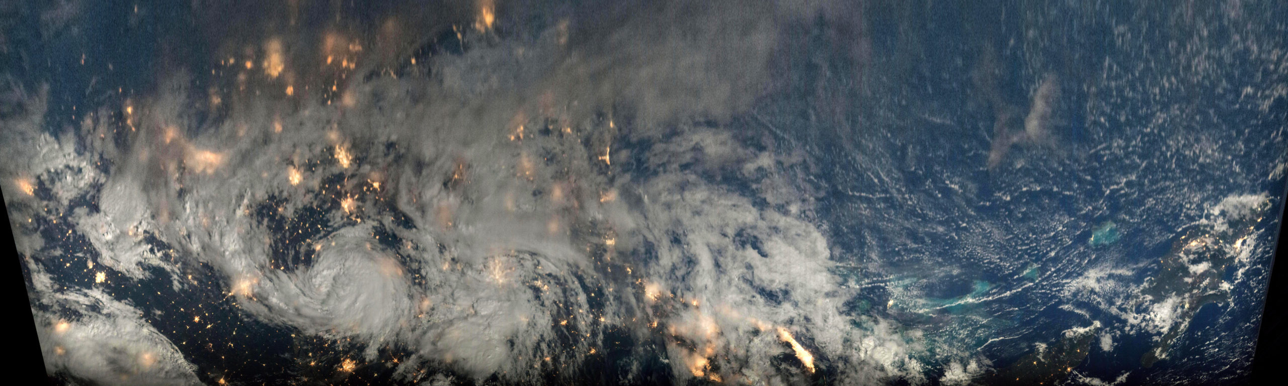
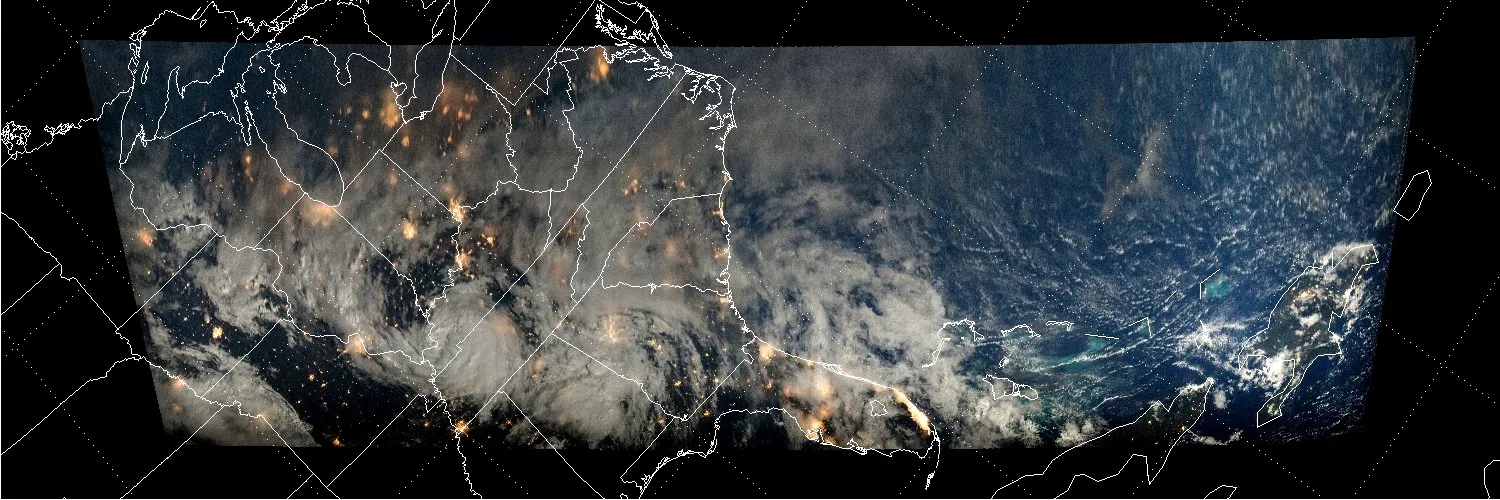
Clearly visible in this moonlit scene are city lights as well as several storm systems, including the remains of Alberto visible about a third of the way across the mosaic from the left. Also visible about halfway into the mosaic is the US Atlantic coast with Florida outlined by its city lights through the breaks in the clouds. In stark contrast to comparatively bright landscape of the US with its many cities and extensive highway system, the eastern half of Cuba and the island of Hispaniola are fairly dark in the early morning hours of May 30. Below is a lower resolution mosaic with a map overlay to aid in identifying landmarks.
The close-up 3D image shown below was created using a subset of the images of Alberto. These images were remapped to approximate an overhead view before being combined to create an anaglyphic 3D image. The resulting stereo view, which can be seen at full size with a scale of about 500 meters/pixel by clicking on the image below, covers an area of 900 by 600 kilometers.
![]()

Related Reading
Drew LePage, “The Hurricane Hunter Satellites”, Drew Ex Machina, May 15, 2022 [Post]
Drew LePage, “Using the Carnot Engine Model to Characterize Hurricanes from Orbit”, TWA Blog, July 23, 2022 [Post]
Drew LePage, “The Impact of New Satellite Wind Measurements on Hurricane & Tropical Cyclone Forecasting”, TWA Blog, January 15, 2023 [Post]
Paul Joss, “The Cyclone Intensity Measurements from the ISS (CyMISS)”, Space Station Research Explorer [Page]

Fantastic site. A lot of helpful info here. I’m sending it to some buddies ans additionally sharing in delicious. And naturally, thanks on your sweat!
Attractive section of content. I just stumbled upon your blog and in accession capital to assert that I get actually enjoyed account your blog posts. Anyway I will be subscribing to your augment and even I achievement you access consistently fast.