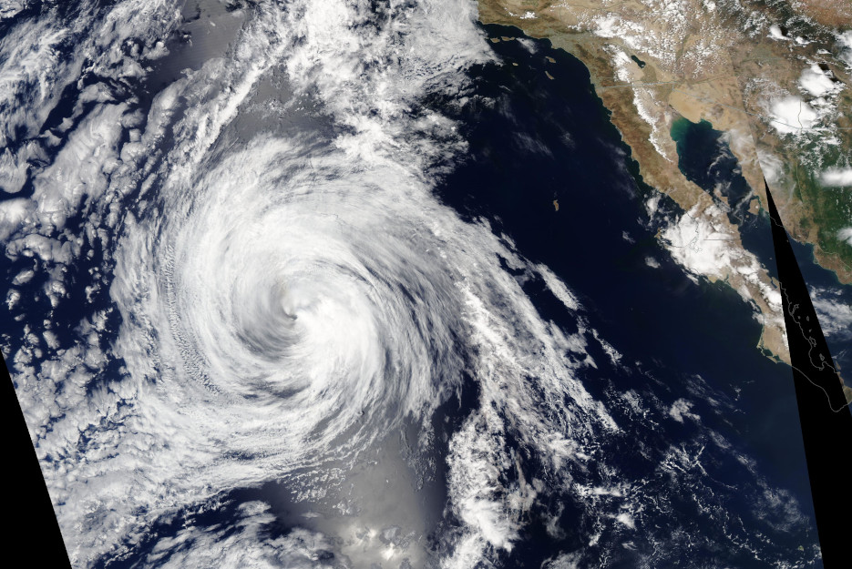
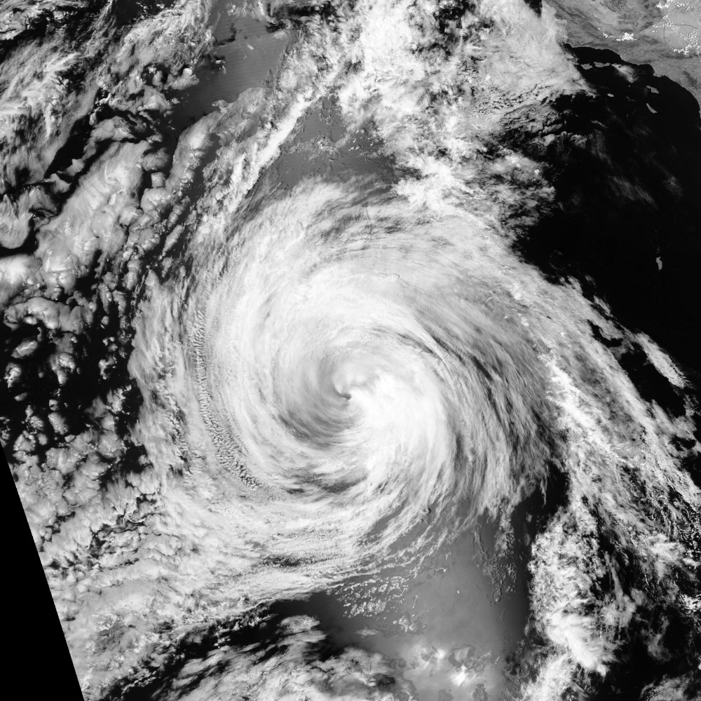
The 2022 Bulletin of the American Meteorological Society (BAMS) article “Accomplishments of NOAA’s Airborne Hurricane Field Program and a Broader Future Approach to Forecast Improvement” summarizes the results of NOAA’s annual Intensity Forecasting Experiment (IFEX) begun in 2005. The Hurricane Research Division partnered with NOAA’s Aircraft Operations Center, which maintain and operate the Hurricane Hunter aircraft and the national Hurricane Center and Environmental Modeling Center, which task airborne missions to gather data used by forecasters for analysis and forecasting and used in the operational numerical weather prediction models. IFEX’s goal is to improve tropical cyclone (TC) forecasts using the Hurricane Hunter data and improving the overall system.
Quoting from the report:
“Improving TC forecasts requires advancements in multiple areas, including developing new observing technologies and strategies that fill existing temporal and spatial gaps in observing networks, improving the assimilation of those observations into numerical models, and improving the models themselves, for instance through the use of observations to evaluate and improve how well a model simulates a TC. Although satellites are one of the primary platforms to observe TC characteristics and improve model initialization through assimilation, aircraft continue to be a necessary platform for obtaining in situ measurements at a spatial resolution adequate enough to resolve structures within the inner core.”
One of the shortcomings noted in this report was the need for more information about TCs in their formative stages:
“The relative lack of flights into the formative (pre-TCs) and early stages [defined as tropical storm (TS), tropical depression (TD)] in the pre-IFEX years had been emphasized as an observing gap at the start of IFEX. …filling this gap during IFEX has been a partial success as TS flights have represented the largest percentage of missions flown in the life cycle—especially in 2020 where half of the NOAA flights were in the TS stage. Flights into the formative stage, however, have been far fewer with only 30 TD and 47 pre-TC (i.e., pregenesis) missions in the IFEX period. And since 2015, the percentage of missions flown at this stage decreased from the first 10 years of IFEX. This decrease reflects the opportunities that different seasons offer within the aircraft operating range and the tasking requirements for the aircraft. A considerable proportion of flights since 2015 have been dedicated to flying operational taskings in TCs threatening landfall, and many of those were already at hurricane strength by the first mission.”
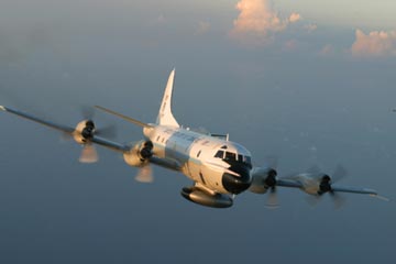
Unfortunately, Hurricane Hunter aircraft do have their limitations supporting IFEX’s recommendations. The range of the various aircraft employed typically limit their coverage to regions near the American mainland. And during especially active periods of some hurricane seasons, available resources only allow the more threatening storms to be observed, as noted above, with targets farther away going unobserved thus affecting their forecasting. More importantly for other regions of the globe which also experience other types of destructive TCs like hurricanes and typhoons, Hurricane Hunter aircraft are not available at all, save for aircraft operated since 2009 by the Government Flying Service Hong Kong monitoring the South China Sea. Meeting the future goals of NOAA’s IFEX to provide more data on TCs, especially in their formative stages far from the continental US, will be difficult relying on the current fleets of Hurricane Hunter aircraft.
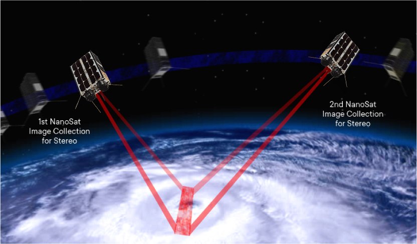
The Hurricane Hunter Satellite constellation, currently being developed by Tropical Weather Analytics, is specifically designed to address NOAA’s future observation goals (see “The Hurricane Hunter Satellites”). Initially consisting of five pairs of 6U CubeSats, the Hurricane Hunter Satellite constellation, with its 100-meter class stereographic imagery, will be capable of not only providing high-resolution cloud cover images, but also cloud altitude measurements to a typical accuracy of ±100 meters as well as 3D winds to an accuracy of ±1 meter per second in each component including unique measurements of the vertical wind component. Using our implementation of the Carnot Engine model for TCs, the accurate cloud top altitude measurements near the eye of these storm, in combination with readily available data supplied by other orbiting assets, will allow a characterization of the strength of these storms more accurately than other remote sensing methods currently in use or under development (see “Using the Carnot Engine Model to Characterize Hurricanes from Orbit”).
With their orbital planes spaced to provide regular daylight observations of any point on the globe, the five satellite pairs of the Hurricane Hunter Satellite constellation can observe TCs during all phases of their development where ever they may be with typical revisit times of 2½ hours. The detailed information that the Hurricane Hunter Satellite constellation can provide about TCs will be vital in meeting NOAA’s future goals of improving their forecasting.
Related Reading
Drew LePage, “The Hurricane Hunter Satellites”, Drew Ex Machina, May 15, 2022 [Post]
Drew LePage, “Using the Carnot Engine Model to Characterize Hurricanes from Orbit”, TWA Blog, July 23, 2022 [Post]
References
Jonathan Zawislak et al., “Accomplishments of NOAA’s Airborne Hurricane Field Program and a Broader Future Approach to Forecast Improvement”, Bulletin of the American Meteorological Society, Vol. 103, No. 2, pp E311-E338, February 2022 [Paper]
