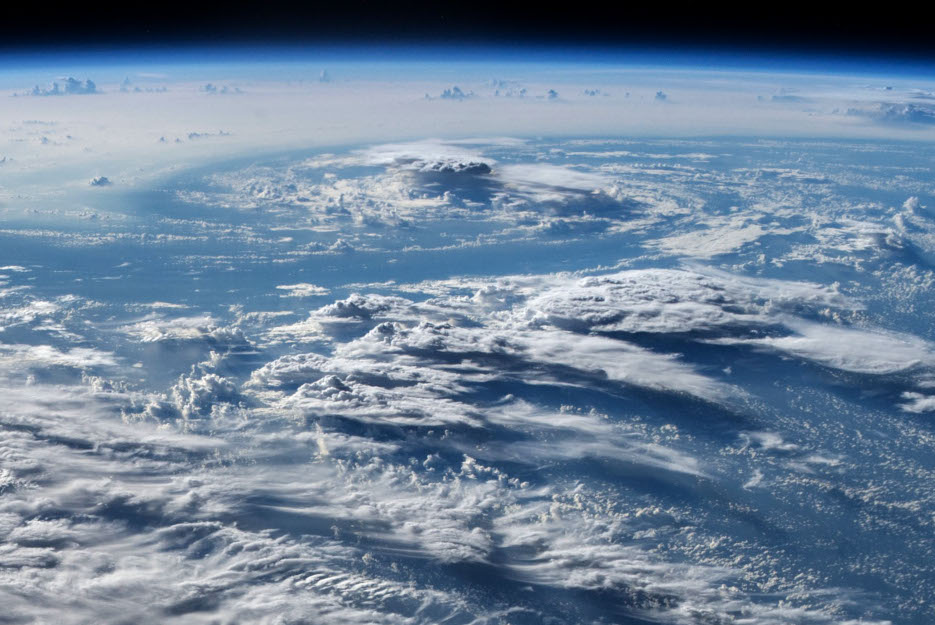
While the Hurricane Hunter Satellites (HHSats) were initiated with the goal of helping to improve the monitoring and forecasting of hurricanes there are many other weather events that the data they collect can be used to monitor. One of these is air turbulence. This may sound strange since HHSats are designed to analyze clouds and their motion in three dimensions. However, as the Boldmethod article “Why You Experience Turbulence When Flying Through a Cloud” explains, clouds can indicate unstable air.
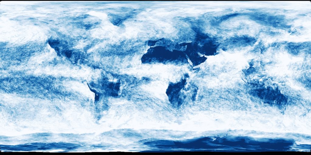
The density of clouds differs from that of surrounding clear air. Their temperature, pressure, and velocity changes also differ from those of surrounding clear air. However, some clouds can be totally smooth. HHSats’ ability to measure wind speeds, by tracking cloud motions with stereographic imagery, facilitates the location of wind shears, which is a critical factor in assessing where turbulence forms. HHSat wind data can also provide information on the vertical component of the wind, which can be indicative of atmospheric instability. Although, as the Boldmethod article notes that, “Clouds can give you a signpost in the sky marking the location of turbulence and hazardous weather conditions. They can mark frontal passages, mountain wave activity, thermals, temperature inversions, and more.” While measurements from other sources such as instrumented aircraft and lower-resolution satellite wind data can be used, the ubiquity of cloud availability for such HHSats’ measurements can be assessed by looking at maps of cloud fraction coverage globally like the example shown below (see “Cloud Fraction” on NASA’s Earth Observatory website for a video and more information).
In summary, HHSats, with their wide-area, 100-meter class stereographic imagery, can provide essential data worldwide that can significantly improve forecasting of turbulence that may result in safer and more comfortable flying, reduction in fuel use by more efficient routes, as well as other benefits in climatology.
Related Reading
Andrew LePage, “The Hurricane Hunter Satellites”, Drew Ex Machina, May 15, 2022 [Post]
Drew LePage, “Satellite Wind Measurements: Wind Shear’s Effects on Weather”, TWA Blog, August 22, 2022 [Post]
Drew LePage, “The Need for Better Satellite Wind Data for Aviation”, TWA Blog, July 27, 2022 [Post]
Jay Jordano, “The Jet Streams and Their Future Characterization”, TWA Blog, July 18, 2022 [Post]
Drew LePage, “How Satellite Wind Data Impacts Weather Forecasting”, TWA Blog, May 23, 2022 [Post]
