
3D Views of Typhoon Noru from the ISS – August 1, 2017
At the time of the CyMISS photography session, Typhoon Noru had weakened to a Category 3 storm with sustained winds of about 185 kph (115 mph)

At the time of the CyMISS photography session, Typhoon Noru had weakened to a Category 3 storm with sustained winds of about 185 kph (115 mph)
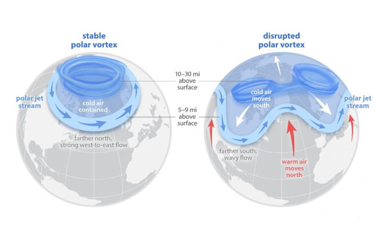
The required vertical resolution for weather and climate applications are not met today over the oceans, tropics, and most of the Southern Hemisphere

Accurate 3D winds aloft would be not only a game changer for weather forecasting, but a critical safety measure for pilots worldwide
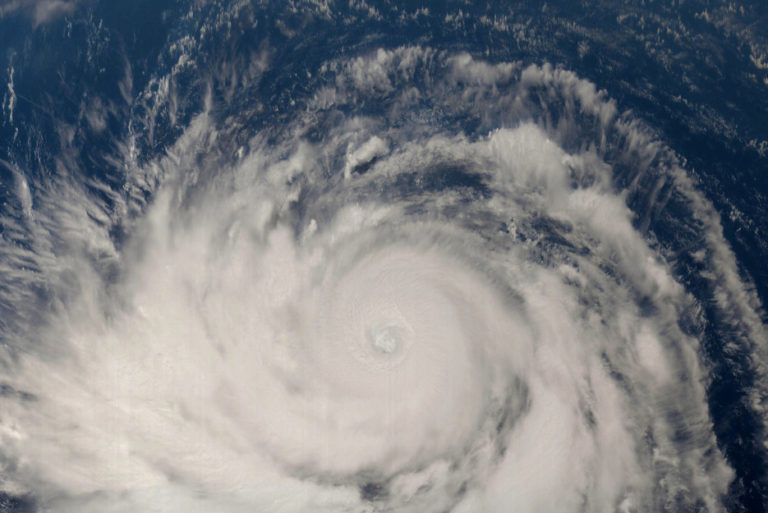
Improved measurements and predictions of tropical cyclone intensity and trajectory would help communities better prepare for such storms
Despite the promising potential of using the Carnot Engine model to characterize the strength of hurricanes using overhead remote sensing data, reliable sources of the required data are simply not available today.
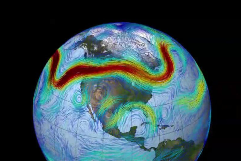
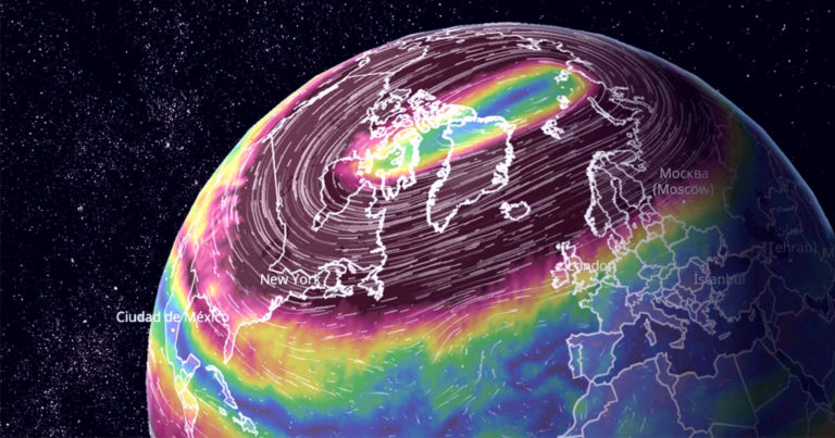
The jet streams are one of the more influential factors in surface weather patterns.
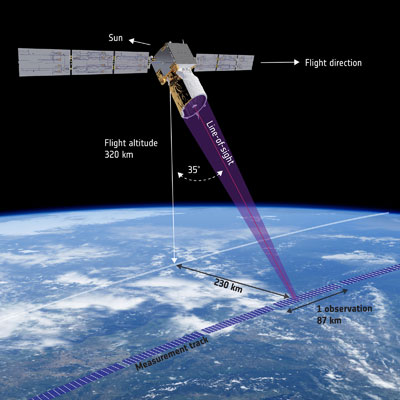
ESA’s Aeolus satellite uses its innovative ALADIN Doppler LIDAR to provide global wind data. This wind data helps meteorologists improve their forecasts.
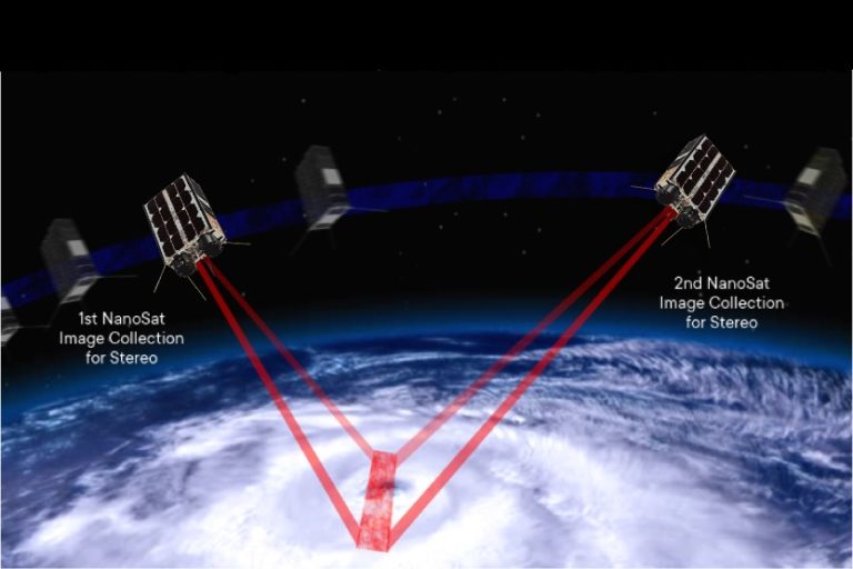
The work at Tropical Weather Analytics, Inc. to perform precision stereo observations of storms was built on years of prior studies and flight experiments. From 2014 to 2019, NASA’s Tropical Cyclone Experiment was performed by the TWAi science team in support

In general, weather forecasters start with all the same forecasting tools to develop their prediction models. Our Hurricane Hunter Satellite constellation will fundamentally change how we forecast weather
Numerical Weather Prediction (NWP) requires high-quality wind and profile data as input to initialize the computer models. The World Meteorological Organization (WMO), for example, maintains a

The Climate Crisis is here and it has never been more imperative for businesses and governments to “weatherize” themselves against a rapidly changing climate that will only grow more volatile as ocean temperatures increase…
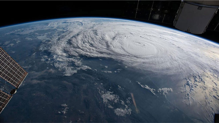
NASA’s Tropical Cyclone Experiment was performed by the TWAi science team in support of the CyMISS (Tropical Cyclone intensity Measurements from the ISS) project funded by CASIS (Center for the Advancement of Science in Space) which manages the ISS US National Laboratory for NASA. In order to accomplish this, the astronauts aboard the ISS had to receive detailed instructions on

© TWAi – 2023. All rights reserved. Developed by CodeStar Digital.